DJI Matrice 5T Uplevels Intelligent Aerial Operations, Day or Night for Challenging Missions
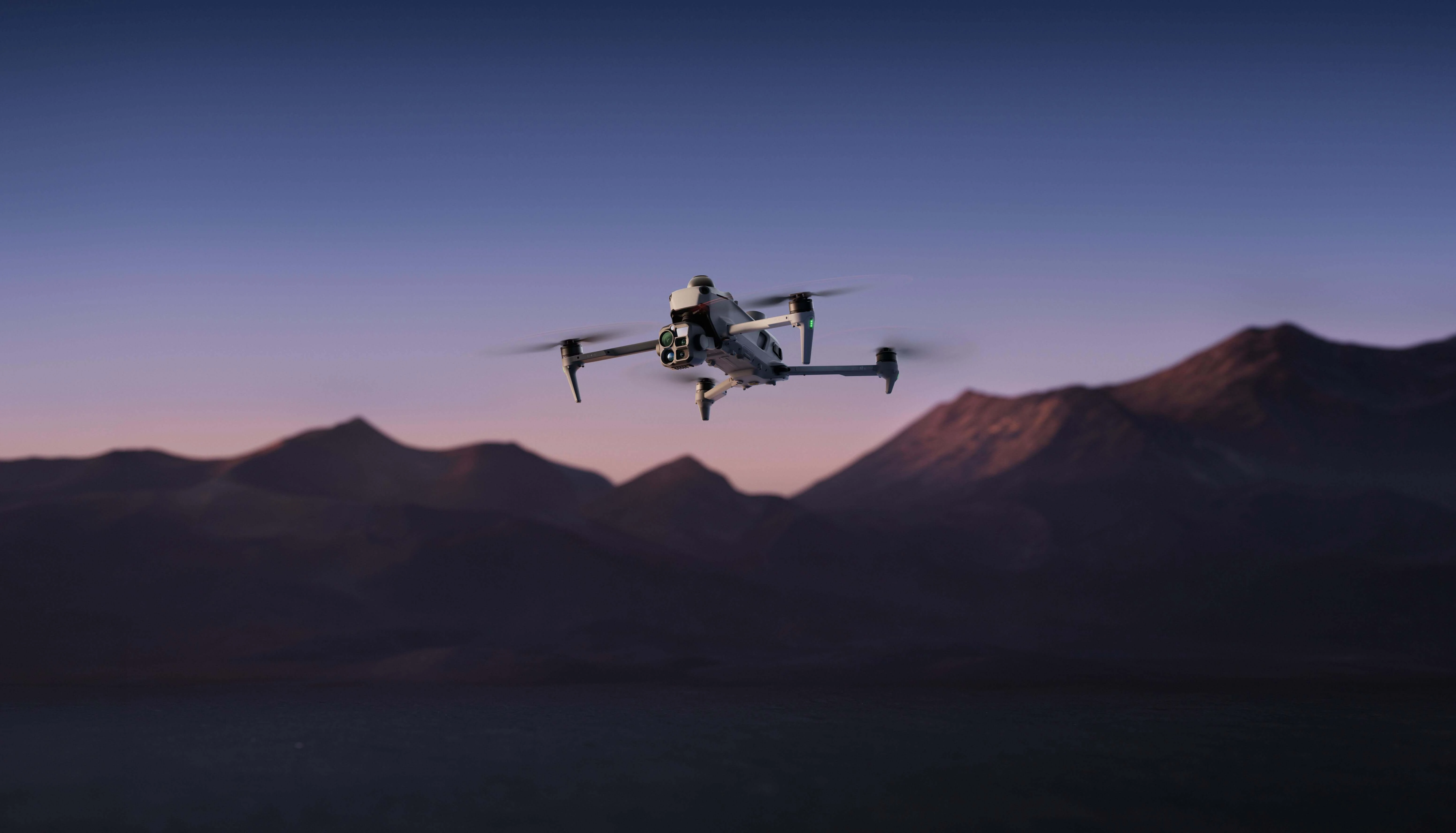
DJI, a global leader in civilian drones and creative camera technology, has introduced the DJI Matrice 5T, its latest compact flagship drone for enterprise applications. The drone combines LiDAR, mmWave radar and vision sensing technologies with 1K thermal imaging and improved night vision capabilities. It also features relay modes to extend transmission range, while Onboard AI and Pilot 2 plugins enable smarter on-site operations. With an IP55 rating¹ for dust and rain protection and a flight time of up to 59 minutes¹, the Matrice 5T offers greater operational flexibility across temperatures ranging from -20°C to 50°C, making it suitable for emergency response, inspections and surveying in challenging weather conditions.
1K Thermal Imaging, Enhanced Night Vision
The Matrice 5T is equipped with an infrared thermal camera offering a native 1K (1280x1024) resolution, providing four times the pixel count of standard 640x512 sensors. With UHR Infrared Image enabled, the resolution can reach 2560x2048, helping identify heat anomalies clearly even in complex backgrounds. Its wide-angle camera features a large 1/0.98-inch sensor and a fast f/1.8 aperture to capture more light. Combined with ISO sensitivity of up to 1,600,000 and AI-powered low-light enhancement, it can produce vivid full-color images in lighting conditions as low as 0.01 lux¹. The drone also includes a medium telephoto camera with a 50 MP sensor and 3x optical zoom, allowing operators to inspect details on power lines and bridges from a distance of 10 metres¹. Additionally, its telephoto camera supports monochrome night vision, 11x optical zoom and up to 176x hybrid zoom, enabling license plate identification from distances of up to 400 metres¹.
Omnidirectional Sensing in Challenging Conditions
For the first time, DJI has combined LiDAR, mmWave radar and an omnidirectional vision system in a compact enterprise drone, enabling reliable environmental sensing in low-light urban environments and completely dark outdoor areas. Equipped with LiDAR, the Matrice 5T can detect narrow obstacles, such as power lines, from distances of up to 32 metres¹, even at night. Its mmWave radar can also detect surrounding objects through challenging conditions, including fog, rain and dust. The omnidirectional low-light sensing system uses full-colour fisheye sensors to maintain visual positioning in lighting conditions as low as 0.5 lux¹, while the upgraded Vision Assist provides full-colour imagery for better situational awareness. In areas with weak GNSS signals¹, such as deep canyons and locations surrounded by high-rise buildings, the Matrice 5T combines visual and radar data to map its surroundings in real time, supporting smooth and stable flight operations.
Open Edge AI, On-Site Intelligence
Equipped with built-in AI models, the Matrice 5T provides operators with enhanced situational awareness across various operational environments. It can identify more than 20 types of targets by simultaneously analyzing thermal and visible-light feeds, including vehicles and vessels. When connected to DJI FlightHub 2, operators can use text and image prompts to search for specific targets through DJI Pilot 2. The platform also allows users to create efficient patrol routes by marking areas on a map and assigning customized actions, such as hovering, capturing photos and videos, or broadcasting audio. Additionally, its open onboard computing system supports third-party models, enabling the flexible integration of custom algorithms.
O4 Enterprise Transmission, Multiple Relay Modes
Powered by the O4 Enterprise Enhanced Video Transmission System, the Matrice 5T offers a maximum transmission range of 40 km¹, an improvement over the previous generation’s 25 km range. Its adaptive multi-band switching technology helps minimize interference in urban environments, while the two built-in DJI Cellular Dongle 2 modules maintain stable connectivity despite physical obstructions¹ by automatically selecting the most suitable network connection. In addition, Smart Relay and multiple relay configurations help overcome signal disruptions caused by challenging terrain during both single-drone and multi-drone operations.
High-Accuracy Surveying, Rapid Modeling
When paired with DJI Terra, the Matrice 5T provides centimeter-level surveying accuracy without the need for ground control points (GCPs). It supports a wide range of applications, from routine inspections to high-precision aerial mapping. DJI Terra can combine thermal images to create 2D thermal maps, measure temperatures and identify anomalies, helping improve efficiency in large-scale solar and power grid inspections. During flight operations, images are transmitted to the remote controller in real time, where 200 photos can be processed in just 8 minutes¹ to quickly generate local point clouds or 2.5D models. The system can also create an initial 3D model directly on the remote controller from a single flight, enabling automatic planning of precise flight routes that follow the contours of a target's surface.
Versatile Applications, Custom Pilot Plugins
The Matrice 5T supports various specialized applications through its intelligent onboard features and flexible software integration. During telephoto operations, its built-in AI foreground segmentation model distinguishes subjects from their backgrounds, reducing visual interference and keeping important details clearly visible. For power line inspections, the drone’s top-mounted LiDAR can detect and track power and ground wires, allowing it to fly laterally along the lines to identify potential hazards, such as damaged strands or suspended foreign objects. It also supports takeoff from moving vessels and can recognize designated landing patterns on ship decks to enable maritime landings. Additionally, DJI Pilot custom plugins allow developers to integrate their own functions into DJI Pilot 2 through floating windows.
Industry-Leading Data Security and Regulatory Compliance
DJI prioritizes data security and gives customers control over how their information is handled. Users must provide consent before sharing photos and videos with DJI, while users in the United States can no longer synchronize their flight logs with DJI servers. FlightHub 2 has received ISO 27001 and ISO 27701 certifications from the British Standards Institution (BSI), confirming that its design, development and operational services meet established information security management standards. Personal information provided during account registration is also protected using AES-256 encryption. Operators can delete any data they have shared through their DJI accounts or by contacting DJI Support. Since 2017, DJI has regularly engaged independent third parties to conduct product security assessments and certifications, including OnDefend, Booz Allen Hamilton, FTI Consulting and Kivu Consulting.
DJI's Flight Termination System (FTS) module is an essential technical requirement for C6 compliance, adding another layer of operational safety for the Matrice 5T when operating in strictly regulated airspace. The system can be activated manually to stop the drone's propellers during flight or triggered automatically if the aircraft crosses its Geocaging boundary, immediately terminating the flight.
DJI Care Enterprise Plus and DJI Official Extended Warranty Service
DJI Care Enterprise Plus, combined with DJI Official Extended Warranty Service, offers comprehensive protection for the Matrice 5T. DJI Care Enterprise Plus provides flexible repair coverage, including one battery replacement annually and Flyaway Coverage Service. Meanwhile, the official extended warranty adds another year of coverage and includes responsive, professional technical assistance to help users maintain reliable day-to-day operations.
Availability
The DJI Matrice 5T enterprise drone is available now through authorized DJI Enterprise dealers.